State Link and Spur Highways
![]() Adams-Colfax
Adams-Colfax
![]() Cuming-Grant
Cuming-Grant
![]() Greeley-Logan
Greeley-Logan
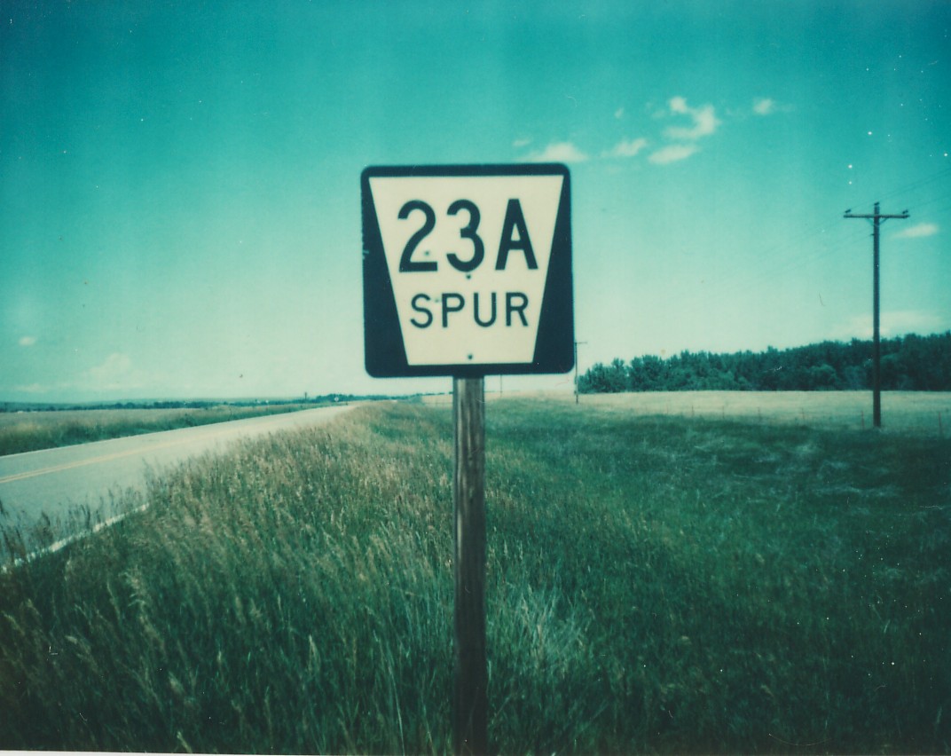
![]() Loup-Saline
Loup-Saline
![]() Sarpy-York
Sarpy-York
www.nebraskaroads.com
Nebraska's highways, byways, roads, and more!
Southern Terminus: US 275 near Beemer
Northern Terminus: NE 51 north of Beemer
Designated: about 1971
Community Passed Through: Beemer
Western Terminus: NE 2 in Anselmo
Eastern Terminus: Victoria Springs State Recreation Area
Designated: about 1971
Community Passed Through: Anselmo
History:
Southern Terminus: NE 40 near Callaway
Northern Terminus: inside Callaway village limits
Designated: about 1971
Community Passed Through: Hastings
History:
Western Terminus: US 183 west of Comstock
Eastern Terminus: inside Comstock village limits
Designated: about 1971
Community Passed Through: Comstock
Decommissioned: 1978 or 1979
Western Terminus: US 20 west of South Sioux City
Eastern Terminus: US 77 in South Sioux City
Replaced by: local roads
History: Decomissioned after US 20 was routed on I-129 and US 77 was shifted to the western South Sioux City bypass.
Southern Terminus: US 20 south of Whitney
Northern Terminus: inside Whitney village limits
Designated: about 1971
Community Passed Through: Whitney
History:
Southern Terminus: US 20 west of Chadron
Northern Terminus: US 385 west of Chadron
Designated: about 1971
History: Turning lane from US 385 to US 20
Southern Terminus: I-80 Exit 231
Northern Terminus: US 30/NE 21 west of Lexington
Designated: about 1971
History:
Southern Terminus: I-80 Exit 248
Northern Terminus: US 30 in Overton
Designated: about 1971
Community Passed Through: Overton
History:
Southern Terminus: NE 40 near Eddyville
Northern Terminus: Eddyville village limits
Designated: about 1971
History:
Southern Terminus: US 30 in Gothenburg
Northern Terminus: NE 47 in Gothenburg
Designated: about 1971
History: NE 47 does not have a junction with US 30 in Gothenburg as there is a viaduct over US 30 and the Union Pacific tracks.
Southern Terminus: I-80 Exit 85
Northern Terminus: US 385 near Chappell
Designated: about 1971
History:
Southern Terminus: I-80 Exit 107
Northern Terminus: US 138 in Big Springs
Designated: about 1971
Community Passed Through: Big Springs
History:
Decommissioned: about 1999
Southern Terminus: US 138 north of Big Springs
Northern Terminus: US 30 north of Big Springs
Replaced by: (demolished)
History: Was turning lane from US 30 to US 138; decommissioned with US 30/US 138 junction altered from Y-intersection to T-intersection.
Southern Terminus: inside Waterbury village limits
Northern Terminus: US 20 north of Waterbury
Designated: about 1971
Community Passed Through: Waterbury
History:
Western Terminus: NE 116 near Concord
Eastern Terminus: University of Nebraska Northeast Experimental Station
Designated: about 1971
Community Passed Through: Concord
History:
Southern Terminus: NE Spur 26B near Concord
Northern Terminus: NE 116 near Concord
Designated: about 1971
History: Turning lane from NE Spur 26B to NE 116
Southern Terminus: NE 12 in Ponca
Northern Terminus: Ponca State Park
Designated: about 1971
Community Passed Through: Ponca
Southern Terminus: NE 91 near Dodge
Northern Terminus: Dodge village limits
Designated: about 1971
Western Terminus: US 275 south of Waterloo (240th St.)
Eastern Terminus: US 6/NE 31 interchange in Elkhorn (204th St.)
Designated: about 1971
Community Passed Through: Elkhorn
History:
Western Terminus: US 275 south of Waterloo (240th St.)
Eastern Terminus: NE Link 28B south of Waterloo (W. Dodge Rd.)
Designated: about 1971
History: Turning lane from US 275 to NE Link 28B; unsigned.
Southern Terminus: NE 92 southwest of Elkhorn (240th St.)
Northern Terminus: US 275 southwest of Elkhorn (W. Center Rd.)
Designated: about 1971
History: Turning lane from US 275 to NE 92; unsigned
Southern Terminus: inside Bennington village limits
Northern Terminus: NE 36 in Bennington
Designated: about 1971
Community Passed Through: Bennington
History:
Southern Terminus: US 275 south of Waterloo
Northern Terminus: NE Link 28D south of Waterloo
Designated: about 1971
History: Turning lane from Link 28D to US 275.
Southern Terminus: US 75 in Omaha (30th St.)
Northern Terminus: I-680 Exit 13 in Omaha
Designated: about 1973
Community Passed Through: Omaha
History:
Southern Terminus: NE 36 south of Washington
Northern Terminus: Washington village limits (in Washington County)
Designated: 1975 or 1976
History:
Western Terminus: NE 133 in Omaha (90th St.)
Eastern Terminus: NE 64 in Omaha (Maple St.)
Designated: 1975 or 1976
Community Passed Through: Omaha
History:
Southern Terminus: Waterloo village limits
Northern Terminus: NE 64 near Waterloo
Designated: early 1980's
Southern Terminus: inside Benkelman city limits
Northern Terminus: US 34/NE 61 in Benkelman
Designated: about 1971
Community Passed Through: Benkelman
Decommissioned: 1978 or 1979
Southern Terminus: NE 41 in Geneva
Northern Terminus: Nebraska Youth Development Center
Replaced by: unmarked roads
History:
Southern Terminus: inside Shickley village limits
Northern Terminus: NE 74 near Shickley
Designated: about 1971
Community Passed Through: Shickley
History:
Southern Terminus: inside Ohiowa village limits
Northern Terminus: NE 74 near Ohiowa
Designated: about 1971
Community Passed Through: Ohiowa
History:
Southern Terminus: Strang village limits
Northern Terminus: US 81/NE 74 near Strang
Designated: about 1971
History:
Decommissioned: 2001
Southern Terminus: US 81 in Fairmont
Northern Terminus: US 6 in Fairmont
Replaced by: (demolished)
History: Decomissioned after US 81 was widened to four lanes.
Southern Terminus: NE 74 near Strang
Northern Terminus: US 81 near Strang
Designated: about 1971
History: Turning lane from US 81 (northbound) to NE 74 (eastbound).
Southern Terminus: US 81 near Strang
Northern Terminus: NE 74 near Strang
Designated: about 1971
History: Turning lane from US 81 (southbound) to NE 74 (westbound).
Southern Terminus: Milligan village limits
Northern Terminus: NE 41 near Milligan
Designated: about 1971
History:
Western Terminus: Nebraska Youth Development Center
Eastern Terminus: US 81 near Geneva
Designated: 1978 or 1979
Community Passed Through: Geneva
Western Terminus: NE 10 west of Upland
Northern Terminus: inside Upland village limits
Designated: about 1971
Community Passed Through: Upland
History:
Western Terminus: Hildreth village limits
Northern Terminus: NE 10 east of Hildreth
Designated: about 1971
History:
Southern Terminus: Naponee village limits
Northern Terminus: US 136 north of Naponee
Designated: about 1971
History:
Western Terminus: US 136/NE 10 near Franklin
Eastern Terminus: NE 10 in Franklin
Designated: about 1971
Community Passed Through: Franklin
Southern Terminus: NE 8 south of Liberty
Northern Terminus: Liberty village limits
Designated: about 1971
History:
Southern Terminus: NE 41 south of Firth
Northern Terminus: Firth village limits (in Lancaster County)
Designated: about 1971
History:
Southern Terminus: Adams village limits
Northern Terminus: NE 41 near Adams
Designated: about 1971
History:
Western Terminus: US 77 near Pickrell
Eastern Terminus: Pickrell village limits
Designated: about 1971
History:
Decommissioned: 1977
Western Terminus: eastern Beatrice (19th St.)
Eastern Terminus: Beatrice State Developmental Center
Replaced by: Lincoln Blvd.
History:
Decommissioned: 1989
Western Terminus: US 136 southwest of Beatrice
Eastern Terminus: US 77 south of Beatrice
Replaced by: unmarked roads
History:
Western Terminus: NE 112 west of Blue Springs
Eastern Terminus: US 77 west of Blue Springs
Designated: about 1971
History: Turning lane from NE 112 to US 77; unsigned.
Decommissioned: between 1991 and 2001
Western Terminus: NE 91 near Burwell
Eastern Terminus: NE 11 near Burwell
Replaced by: (demolished)
© 2002 - 2003 Jesse Whidden
Last Modified 6/26/2003